Compare CDR calculated from porewater data across different field sites in Scotland
Introduction:
UNDO has six different MRV field sites, based in Scotland. Data from a wide variety of sources are being collected with the aim of quantifying carbon dioxide removal, but this app only shows porewater data.
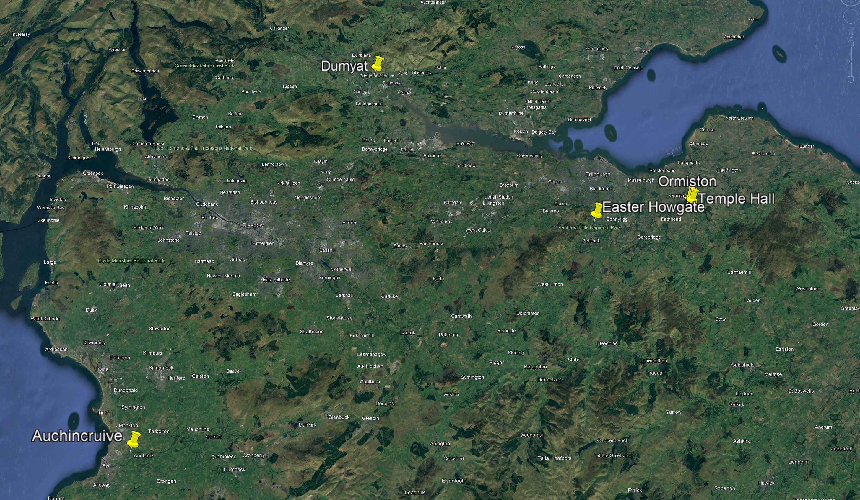
Site map:
Here is a map showing the location of the different sites, along with mean annual temperatures and total annual precipitation (during the experimental period)

Rock applied to use in trials:
At the Dumyat site:
At other sites:
Application density: 0, 23, 78 and 126 t/ha
Application density: 0. 20 and 40 t/ha
Mineralogy: 54.0 wt.% Andesine 18.9 wt.% Augite 9.5 wt.% Chlorite 6.5 wt.% Smectite 7.8 wt.% Quartz 3.2 wt.% Glass
Mineralogy: 41.1 wt.% Andesine 18.0 wt.% Amorphous 15.3 wt.% Amphibole 6.5 wt.% Augite 5.6 wt.% Chlorite 4.6 wt.% Quartz 3.7 wt.% Muscovite 1.6 wt.% Ilmenite 1.3 wt.% Magnetite 1.3 wt.% Calcite 1.1 wt.% Smectite
Particle size: D50 = 1006 um (microns)
Particle size: D50 = 963.5 um (mircons)
BET SSA: 0.977 m2/g
BET SSA: 0.842 m2/g
Different experimental designs:
At the Dumyat site:
At other sites:
1 x 0.5 ha site per treatment, 3 rhizons per depth per plot
6 x 10x6 m plots per treatment, 1 rhizon per depth per plot
5 year climate averages:
Climate averages during experiment:
Site comparison:
(1) From the dropdown menu, please select your sites:
181 / 365
(2) View precipitation data during field experiment
(3) CDR comparison
Note: Temple Hall and Ormiston were fertilised early in 2024, near when spikes in cations are observed. We are yet to resolve the complications of this with regards to CO2 removal